The Journey Begins
On October 26, a group of us from the UNBC Outdoors Club set out for Caledonia Mountain, a hidden hike about 2-3 hours from Prince George. It was a very rainy morning, which made it very difficult to get to the meeting spot, and a few people who said they were going were no-shows. Fortunately, having less people show up made driving there much faster, since we only had one car. Getting there required navigating the Bowron and Tumuch Forest Service Roads, where loose gravel makes for a cautious but fun drive. As we drove, I mentally prepared myself for 4-6 hours in the pouring rain and wet snow.
Trail Conditions
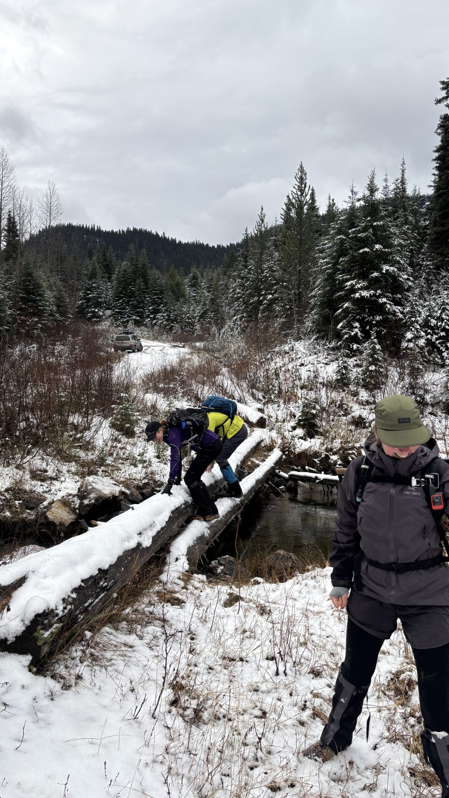
Luckily, once we got to the trailhead the rain and snow had stopped, our reward for showing up to brave the elements. Our adventure began at the end of a narrow road off Tumuch FSR, where we were immediately challenged by a creek crossing on large, frost-covered logs. Once across, we entered a second-growth spruce forest that led up to a more open, yet barren area. This section seemed like it had burned long ago, leaving muddy terrain that hadn’t fully regrown. Halfway through this clearing, the snow began to deepen, with each of us taking turns creating a trail.
[Creek crossing at the beginning]
The Ascent
As we continued past a large pond, we tried to reach the ridge using an alternate route by zigzagging through deep snow. Small balls of snow kept forming underfoot and rolled down, gathering size in the classic “snowball effect.” At this point, one of my gaiters decided to break, letting a generous amount of snow enter one of my boots. This didn’t really matter though, as my socks were already pretty wet. The real challenge began as we approached the ridge, where we were hit by some of the strongest winds I had ever experienced. Rain jackets were hurriedly thrown on, and everyone fought to keep their balance and prevent their gear from blowing away. The wind was relentless, making it hard to stay upright.
[Switchbacks we created to get up the ridge]
Summit Success
At the summit, we found a sheltered depression in the rock to escape the wind and enjoy a much-needed lunch. Despite the fierce weather, the breathtaking views of snow-covered peaks and vast wilderness around us made it all worthwhile. Even though the sun wasn’t setting, the horizon was glowing a beautiful orange, making it look like the entirety of western BC was on fire.
[View heading down from the peak]
The Descent
On the descent, we practically ran down the ridge, using the snow as a soft cushion in a style similar to scree skiing. Outdoors Club Executive Ben decided to try and roll down, which ended up being pretty brutal with his pack still on. Our pre-made trail from the hike and gravity made the return much easier, though the clearing was now muddier and slipperier than ever, resulting in a few memorable wipeouts. In total, we covered 9.09 km with 978 meters of elevation gain, pushing through snow, intense wind, and muddy terrain. We congratulated each other for showing up even though we were expecting a miserable rainy day.
Getting There
A detailed description of how to get to this trailhead is available on the Caledonia Ramblers website. An AWD or 4×4 vehicle is definitely required if you want to drive there in the fall or winter, unless you want to add a few kilometers onto your hike from the Tumuch FSR.
Join Us!
If you are a UNBC student, you can join the Outdoors Club if you want to go on fun, challenging trips like this!
Trip Statistics:
- Distance: 9.09 km
- Elevation Gain: 978 meters
- Location: ~2-3 hours from Prince George
- Required: AWD/4×4 vehicle (fall/winter)


